Fabulous Philippines > Baguio City
Baguio City
Share this page:
Located on a plateau in the mountains of northern Luzon, Baguio City is a cool escape and holiday destination. Baguio is one of the few places in the tropical Philippines with a cool climate, being is on the average eight degrees cooler than places in the lowlands.
Baguio is situated among pine-covered hills, and is often called the City of Pines. Also it is dubbed the City of Flowers in honor of its annual flower festival, the Panagbenga Festival.
The city is an important educational center (hosting five universities and the Philippine Military Academy) and spiritual center (famous for its faith healers). It is an important market and transport center for the mountain people of the Cordillera (mountain) region of Luzon island.
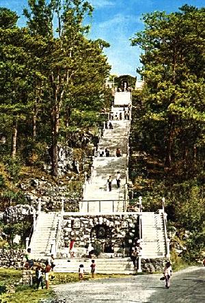
Lourdes Grotto, Baguio
Some of the great places to visit in Baguio City:
-- Asin Hot Springs
-- Baguio Cathedral
-- Baguio City Market
-- Burnham Park
-- Camp John Hay and Cemetery of Negativity
-- Lourdes Grotto
-- Mansion House
-- Mines View Park
-- Philippine Military Academy (PMA)
-- Rizal Park
-- Wright Park
-- Baguio Botanic Gardens (Imelda Park)
-- Crystal Cave
-- Dominican Hill
-- Jesuit Observatory, Mirador Hill
-- Bell Church
-- Good Shepherd Convent
-- Ifugao Woodcarvers' Village
-- Easter School of Weaving
-- Baguio Mountain Province Museum
-- Filipino-Japanese Friendship Garden
Festivals and events include:
Panagbenga Festival
A Little History
Until the late 19th century there were just a handful of houses where Baguio now is (the settlement was then known as Kafagway).
Ever since the 16th century Spanish Catholic friars has trekked to the area and were impressed by its fertile valleys and its minerals such as copper and gold. However, they found the area too rugged and inhospitable to settle.
With the arrival of the Americans in the Philippines in 1898, the new colonizers set their minds to finding a cool hill station as a getaway for their administrators from the heat and humidity of the capital, Manila (similar to the British hill stations of the Cameron Highlands in Malaya and Simla in India). The present-day site of Baguio was selected and a winding road built up to there from the lowlands (named Kenyon Road after the U.S. engineer who designed it). The layout of Baguio was carefully designed by town planners and architects and was proclaimed a town in 1900 and then a city in 1909.
Baguio was greatly affected by the Second World War. The first bombs to fall on Philippine soil during World War II fell on Camp John Hay in Baguio. The conquering Japanese general, General Yamashita, set up his Philippine military headquarters in Baguio. When the Japanese were forced to quit the Philippines in 1945, Yamashita signed the instrument of surrender at Camp John Hay in Baguio.
There was a severe earthquake in Baguio City in July 1990. The quake measured 7.7 on the Richter scale. It killed hundreds of people and destroyed or damaged many public and private buildings (for example, the Holiday Inn collapsed), the airport and Kenyon Road. Fortunately, most of the damage has been repaired and now signs of the catastrophe are hard to find.
Sadly, much of the fresh and pristine environment regarding which Baguio used to pride itself is gradually disappearing. The population is expanding at a rapid rate and many of Baguio's famous pine trees have been cut down to make way for real estate developments.
Share this page:
Author: David Paul Wagner
(David Paul Wagner on Google+)
|